Counties should emulate Vihiga on technology

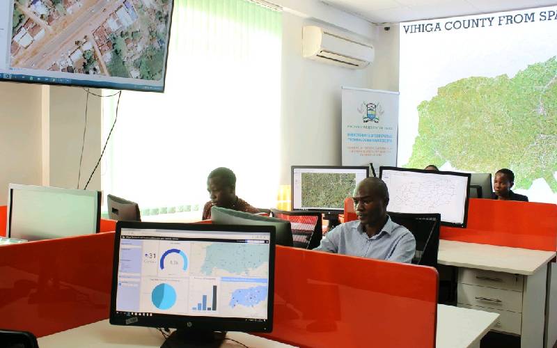
An information lab at Vigiga County used to guide planning of development projects. [Courtesy]

It is Sukant Ratnakar, a renowned motivational speaker and author who said: “Our future success is directly proportional to our ability to understand, adapt and integrate new technology into our work.

Encyclopedia Britannica defines technology as the application of scientific knowledge to solve the practical problems of human life. Technology and development have a long-standing correlation and the former is credited for various industrialisations and advancements throughout history.

In today’s world, technology is part and parcel of development agenda in every industry and sector, be it agriculture, healthcare, education, transport, financial services, sports or fashion. It is a crucial cog in achieving sustainable development, especially in Africa that still lags behind in the creation and adoption of new ideas to enhance service delivery.

However, there are some success stories. One of the best examples is M-Pesa, a home-grown innovation that has revolutionised mobile money transfer and placed Kenya on the global technology map.

In a bid to perhaps encourage the adoption of technology by counties, the law requires them to use Spatial Information Technology. According to part eleven of the County Government Act 2012 which is about County Planning, every county government in Kenya must develop a planning framework for the county and no public funds are to be appropriated outside of this. Clause 105 (1)(f) specifically states that a county planning unit shall be responsible for ensuring the establishment of a GIS-based database system. GIS is an acronym for Geographic Information System.

According to ESRI – a global market leader in GIS, it is a system that creates, manages, analyses and maps all types of data. It connects data to a map, integrating location data (where things are) with non-location data like population density and other descriptive information that provides details on what things are like at a specific location, to quickly identify patterns that may otherwise be overlooked.

Despite the implementation of GIS by counties being a legal requirement since 2013, very few counties have adopted and integrated this technology. Vihiga county has excelled in implementation of GIS to map out gaps and improve service delivery to the people. Last year at the onset of the Covid-19, the county used GIS technology to identify possible hotspots and monitor the spread of the virus. It is also through GIS, that the county successfully reduced maternal and infant mortality rates by ensuring all health facilities are located within a 5km radius.

Vihiga is an example of how counties can use technology to deliver their development agenda, streamline operations like budgeting and revenue collection.

Ms Taa is a Governance Analyst and Fashion Designer. [email protected]