The beauty, life of Mara under threat

Activities along the course of the Mara River on its way through the Maasai Mara Game Reserve towards Lake Victoria. [Jeckonia Otieno, Standard]

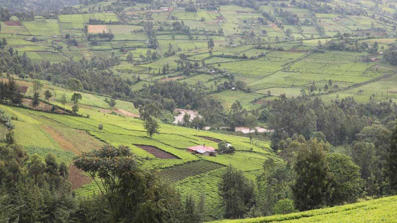
Mara River makes a majestic flow down from the Mau. It is full of life. The river is one of the major drivers of tourism in Kenya, not just through the wildlife it supports but also the spectacular wildebeest migration, which is a month away.

However, activities along the two main tributaries affect the ecosystem directly.

Even with the rainy season on and lots of green pasture all around, there are still livestock all over the Enapiuapiu Swamp from where River Amala begins. It is one of the main tributaries of the Mara River; the other is River Nyangores which starts in Bomet.

Fredrick Lesingo, who grew up in Kiptunga Forest in which the swamp lies, says grazing in the swamp remains a contested issue. But that is not the only problem. He says the exotic trees brought in by colonialists also pose a major threat to the water tower.

“Natural trees were cut and the blue gum introduced and it is known for taking up lots of water which poses a threat to the swamp,” says Lesingo who proposes that the swamp be fenced off to keep cattle at bay.

He says the swamp can even be turned into a tourist attraction. The swamp acts as the source for two other rivers – Molo and Njoro.

But fencing off the swamp seems not viable. Kiptunga Forest Station manager Robert Ngotho says the idea was shelved because it would have set locals against conservation efforts.

“There was an agreement that locals should not graze within the swamp area but now there are so many cows. But we believe negotiation and inclusion is better than the use of force if the conservation dream is to be realised,” says Ngotho.

The ban on logging, which has been extended for another six months, seems to have slowed down degradation of the Mau.

Mwai Muraguri, the ecosystem conservator for Narok County, says charcoal burning could have killed the forest alongside illegal logging coupled with the need for agricultural land.

“In Narok, people plant wheat and barley which leads them to clear forests for more land but we have the situation under control because apart from conducting highway patrols, we also engage community forest associations (CFAs) on how to sustainably utilise forest resources,” says Muraguri.

He says Nyakweri Forest was the hardest hit and the wanton destruction left River Amala with foul water.

He says the water is getting clearer with the conservation measures and efforts that have been put in place.

Activities along the course of the Mara River on its way through the Maasai Mara Game Reserve towards Lake Victoria. [Jeckonia Otieno, Standard]

Pollution and siltation

Crooks nevertheless have used all manner of tricks to beat the system, including transporting logs and charcoal in matatus. So far, 26 cases of people who have flouted the ban on logging have been prosecuted successfully.

Along its way to the confluence on the border of Narok and Bomet counties, River Amala faces immense threats of pollution and siltation.

At Mulot town on the border of Narok and Bomet counties, raw sewage is emptied into the river with reckless abandon from hotels and residential households.

Motor vehicle cleaners beside the river have not spared it either as they use the water and let it flow back into the river. Add this to siltation due to destruction of vegetation cover upstream, the danger to the Mara can only increase.

While farming is a major contributor to river water degradation due to siltation, World Wide Fund (WWF), an organisation for nature conservation, works with farmers to ensure siltation and discharge of chemicals back into the river is minimised.

Kevin Gichangi, the WWF coordinator for Mau, Mara and Serengeti Area, says uncontrolled grazing and poor farming practices are among the human activities threatening the Mara Ecosystem.

“While uncontrolled grazing is a challenge, it is being managed through the CFAs in partnership with the Kenya Forest Service (KFS). On the other hand, cultivation too close to the river has led to sedimentation that is thrice above the allowed levels,” says Gichangi.

Some of the interventions include training farmers on responsible farming methods.

Retired Chief John Katam is one of the farmers along the slopes of Bomet East from where River Nyangores starts.

His farm, which stretches to the Chepkosio Stream, is punctuated by rows of Napier grass. The grass is turning out to be the panacea to the rampant erosion that would be witnessed whenever it rained.

“My farm was always affected by erosion until I was trained and started planting Napier grass across the slope and digging a retention ditch immediately beside the row of grass,” says Katam who grows tea, maize and potatoes.

While the grass holds together the soil and breaks the speed of runoff, the retention ditch holds any silt that could be washed to the river, thus reducing water turbidity.