The intriguing questions behind ill-fated flight

A boy carries a metal box, believed to hold information about the crashed aircraft's date, at Aberdares forest. [Elvis Ogina.Standard]

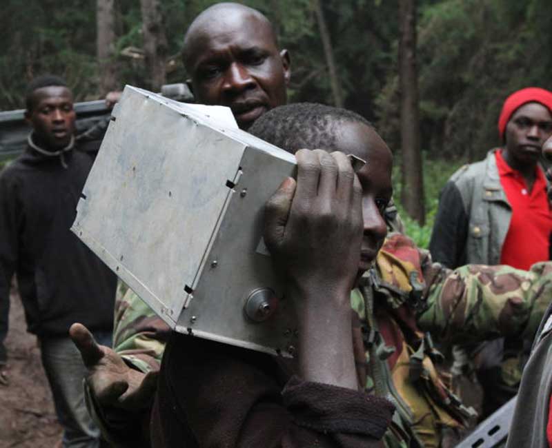
The effectiveness of aircraft emergency safety systems is expected to feature as investigators probe last week's plane crash in Aberdare Forest.

The team yesterday visited the scene of the accident in which 10 people were killed on Tuesday.

Experts say the Instrument Flight Rules (IFR) and Visual Flight Rules (VFR) - two instruments pilots rely on to find their way - will be of interest to the investigators probing what caused the Cessna to come down at 11,000 feet.

Investigators will also look into the status of the Emergency Locator Transmitter (ELT), which is usually fitted in the tail - a part that is hardly destroyed during a crash- and why it took so long to locate the wreckage.

When pilots cannot see where they are going, the IFR is what guides them on the best altitude to fly at and how many degrees to turn among other things. This explains why it is possible for planes to fly at night.

“It is not a question of not being familiar with the path; what should be looked into is the GPS (global positioning system) of the plane,” said a source familiar with aviation industry.

Previous reports revealed that the plane was supposed to land at Wilson Airport in Nairobi but was diverted to Jomo Kenyatta International Airport (JKIA).

Pilots conversant with the incident indicated that the pilot had hinted that she was not familiar with the route she was given by the JKIA control tower.

Usually, the GPS of a plane is updated every 28 days. This is done by inserting a disk in the dashboard of the plane just like a computer. If the pilot was not familiar with the route, this is where investigators are expected to dig into.

Similarly, from VFR regulations, a pilot is able to see how conducive the weather is and plan ahead for the flight. This is with the help of a weather radar, which comes in handy at night or when there is mist or fog.

The Cessna 208B-0525 crashed into Elephant Hills of the Aberdare Ranges, known for terrible weather that greatly impedes visibility.

Not even efforts by the National Disaster Management Unit (NDMU) to use helicopters in the rescue mission worked despite having seven available, including a sophisticated KAF 1101 Kenya Air Force chopper.

In this instance, the source revealed, the weather radar should have warned that they were approaching terrain with bad weather.

“There is no pilot who will see a hill or terrible weather and just proceed,” the source said.

According to the Technical Training Manual of the Cessna 208 Caravan on terrain and obstacle, there are colour codes that will alert a pilot in case of bad weather, which are red, yellow and black.

Black means the terrain or obstacle location is more 1,000 feet below airplane altitude. This means there is no danger.

“Know location of obstacle. Be prepared to take action,” reads the 2013 manual. Red means the terrain or obstacle is at or within 100 feet below airplane altitude, whose alert level is a warning.

“Climb and or turn away from the terrain or obstacle,” adds the plane’s training manual.

According to an aviation library, Skybrary, an ELT broadcasts distinctive signals on designated frequencies and, depending on application, may be automatically activated by impact or be manually activated.