Premium

Riparian land: When the law puts builders in hot water

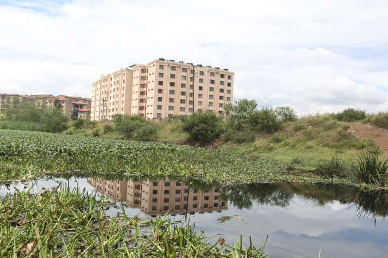
A residential building near Nairobi Dam that was earmarked for demolition in 2018. [File, Standard]


In 2018, numerous house owners in Nairobi were sweating over the possibility of their property being demolished.

A report by the National Environment Management Authority (Nema) dated June 26, 2018 said the government had earmarked buildings sitting on riparian land, which were to be flattened.

Authorities warned that the crackdown would affect about 4,000 buildings that were deemed to interfere with the hydrological and ecological balance.

A number of buildings were actually brought down by the Nairobi River Regeneration team led by Nema.

“There are approximately 4,000 buildings, structures and even facilities on riparian land in Nairobi and we are targeting them all,” said the Nairobi River Regeneration task force’s operations manager Julius Wanjau.

A section of Seefar Apartment in Nyayo Highrise, Nairobi on Saturday October 27, 2018.National Environment Management Authority (NEMA) has earmarked the building for demolition as it sits on Nairobi Dam's riparian reserve land. [Edward Kiplimo,Standard]

However, it was not - and has never been - very clear to many what riparian land is, and where it extends.

The question of how wide the riparian land is on different waterfronts has never been accurately answered, and even land experts are not certain on where the law stands.

Ibrahim Mwathane, chairman of the board at Land Development and Governance Institute and a former chairman of the Institution of Surveyors of Kenya (ISK), says the definitions of riparian land leaves a lot to be desired.

The interpretations, all rooted in law, conflict.

“If you own land bordering a river or through which one passes, how far from the river should you construct or farm? What guides you?” he asked.

There are different laws on riparian land, and different interpretations of the same, and as such, players will choose what interpretation of the law favours them most.

Developers, professional practitioners, landowners and state regulators are unable to meet at a point of agreement.

The ISK, when commending the demolitions that were to aid in reclamation of riparian land in Nairobi, decried what they termed as “multiplicity of laws”.

“The problem affecting the conservation of riparian land in Kenya, in our view, is affected by the legislative regime that determines the use and management of these areas. The laws are apparently too many and fragmented,” the institute said in a statement in 2018.

“These laws prescribe various measures of the riparian width on the same river and also determine the zone from various areas of reference.”

ISK said there was need for the government to develop a policy to address the existing gaps in the management and conservation of the riparian reserves.

“The existing riparian reserve boundaries need to be mapped and geo-referenced. This would help minimise conflicts and uncertainties with the adjoining private land,” it said.

The 1989 Survey Act provides that for surveys of government land (nowadays public land) a reservation of a minimum 30 metres in width above high-water mark should be allowed.

This is for tidal rivers only. Smaller rivers are not mentioned.

Mr Mwathane said the Act, in talking about government land and tidal rivers, leaves a lot of questions unanswered. 

“So what is the position for surveys on community and private land? Who determines the high-water mark for the many tidal rivers around the country?”

On many plans that cartographers make, the river reserve widths are not defined. The legal boundary is marked as the centre line of such rivers.

A section of Seefar Apartment in Nyayo Highrise, Nairobi on Saturday, October 27, 2018. National Environment Management Authority (NEMA) has earmarked the building for demolition as it sits on Nairobi Dam's riparian reserve land.[Edward Kiplimo,Standard]

The Agriculture Act also instructs on the modalities of land use and defines the riparian reserve differently.

“Any person who, except with the written permission of an authorised officer, cultivates or destroys the soil, or cuts down any vegetation, or depastures any livestock on any land lying within two metres of a watercourse, or, in the case of a watercourse more than two metres wide, within a distance equal to the width of that watercourse to a maximum of 30 metres, shall be guilty of an offence,” reads the Agriculture Act Cap 318 of 1965.

In addition, there are separate regulations in the 1996 Physical Planning Act.

During the submission of sub-division plans for consideration of approval, the Act states, reserves provided along any river, stream or watercourse shall not be less than 10 metres wide on each bank.

This applies except in areas where there is established flooding.

Further, the Environmental Management and Coordination Act, 2015 provides that no person shall cultivate or undertake any development activity within full width of a river or stream to a minimum of six metres and a maximum of 30 metres on either side, based on the highest recorded flood level.

The 2016 Water Act establishes a Water Resources Authority, an organ of the national government which was known as the Water Resources Management Authority under the 2002 Water Act.

It regulates the management and use of water resources in Kenya.

It says that building of permanent structures shall not be done within a minimum of six metres or equal to the full width of the water course up to a maximum of 30 metres on either side of its banks.

Mwathane said the recommendations of a technical team that was put in place to harmonise the laws and remove the grey areas are yet to be put to public participation.

He said it is likely that there was insufficient inter-sectoral collaboration during the enactment of the various laws.

Section 29 of the Physical Planning Act empowers local authorities to prohibit or control the use and development of plots within its area. It mandates the local authority to consider and grant development permissions.

But even as talk of people’s encroachment on water courses continues, there needs to be effort to have clarity in definition and a harmonisation of laws.

Otherwise, opposing parties will look for the law that favours them and no one will be held culpable for breaking the law.