Lamu town maps out her future, new direction

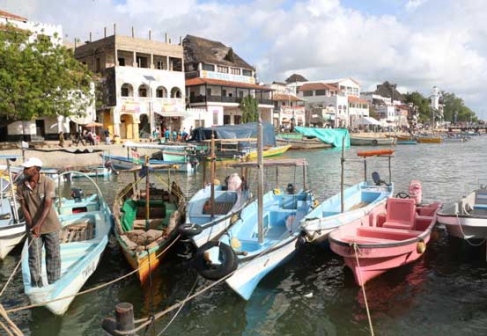
What comes to mind when you hear of Lamu? Today, many would say insecurity with the number of attacks by Al Shabaab in the area in mind.

Before the insecurity tag reared its head though, Lamu was better known as a heritage site. For those who have been to Lamu town, the narrow streets and ubiquitous donkeys, would no doubt get a mention.

The fame of Lamu Island has for along time drawn more attention and fame than the rest of the sprawling county that borders Kilifi and Garissa counties, Somalia and the Indian Ocean.

One of the reasons for this was disproportionate focus on the island and near total exclusion of the rest of the county. This is something that the recently launched Lamu County Spatial Plan seeks to change.

The county prides itself as among the first to complete what is a mandatory requirement for all county governments. Lamu County Executive Committee member for land, physical planning, infrastructure, urban development, water and natural resources Amina Masoud is upbeat that the completion of the process is a step in the right direction. “There is a lot to be done in Lamu. We want to bring sense into the land use management in the county,” she says.

The spatial plan, developed with stakeholders like the World Wide Fund for Nature (WWF) presents a guideline to the development of the county. Lamu has less than ten kilometers of tarmacked road. It is this lack of infrastructure that also exacerbates the problem of insecurity.

The all weather road that connects the county to her neighbours in the south is today a highway of fear. Stalked by terrorists and bad conditions.

When we drove from Lamu to Mpeketoni, further south, the sense of caution is palpable. The spatial plan recognises the need to develop infrastructure in a bid to improve connectivity.

The spatial plan gives a framework of planning town and villages, allocating functions to towns. Mokowe is the headquarters, Witu (gate town), Kiunga (fishing and trade town) and Lamu the investment and heritage town.

Stakeholders have faith that the plan will change a lot. “The plan recognises that lamu is water scarce county and sets out the protection of water catchment areas and sources like Shela sand dunes on the Lamu Island that are under threat from human activity,” says Vincent Osewe, a County Physical Planner in Lamu. He says the plan acknowledges unique resources of Lamu and how they are protected and developed.

Masoud points out that Lamu hosts key elements of the Lapsset projects and would therefore benefit more by being ready for the attention to come.

It is this attention and challenges like conservation that make this plan timely. Take the question of Lake Kenyatta in Mpeketoni for instance.

The land around here is possibly one of the biggest sources of watermelon, consumed as far as Nairobi. However, the enthusiasm for this and other crops form a threat to water resources in the area with farmers upstream of the lake encroaching on water ways and the silt flowing downstream filling up the lake.

“At one time, the lake’s deepest part was four metres, this is now less that a one metre. There is a lot of siltation,” says Pius Kimani Mutie, a farmer Mpeketoni and the assistant secretary of Lake Kenyatta Water Association.

Mutie blames the sad situation on the culture of ‘witemere’ upstream. This is where people move into unallocated land and carve out portions for agricultural activity.

“Lamu is rich in natural resources. We need to conserve these resources,” says Masoud.

The spatial plan was launched last week after having gone through an extensive public engagemnet and county assembly approval. Masoud explains that it was important to push through the approval before elections, adding that after elections, the focus will shift to implementation.