×

The Standard e-Paper
Smart Minds Choose Us
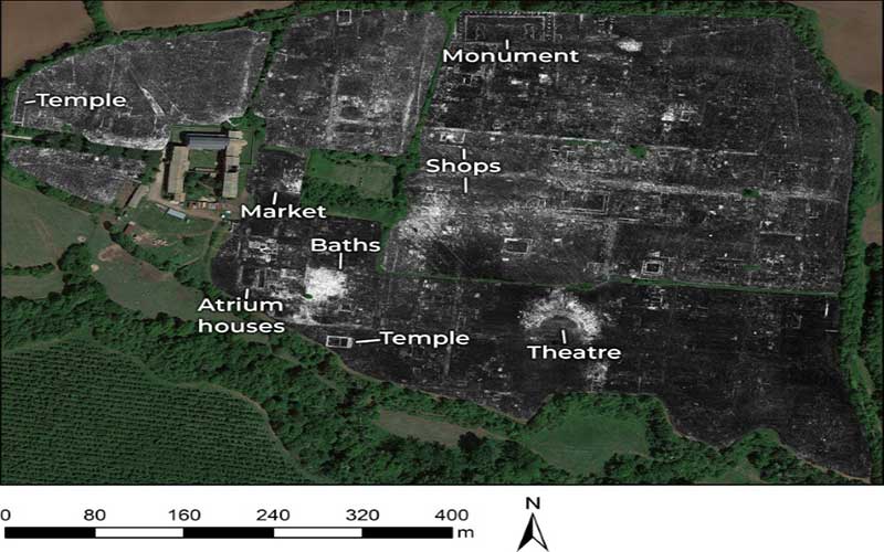
The splendour of long-buried Falerii Novi in the Tiber River valley was revealed without overturning a single stone
Scientists have unveiled the contours of an ancient city north of Rome for the first time, and all they needed was a quad bike and a radar gun.
Subscribe to our newsletter and stay updated on the latest developments and special offers!