Mapping app helping Ogiek preserve heritage

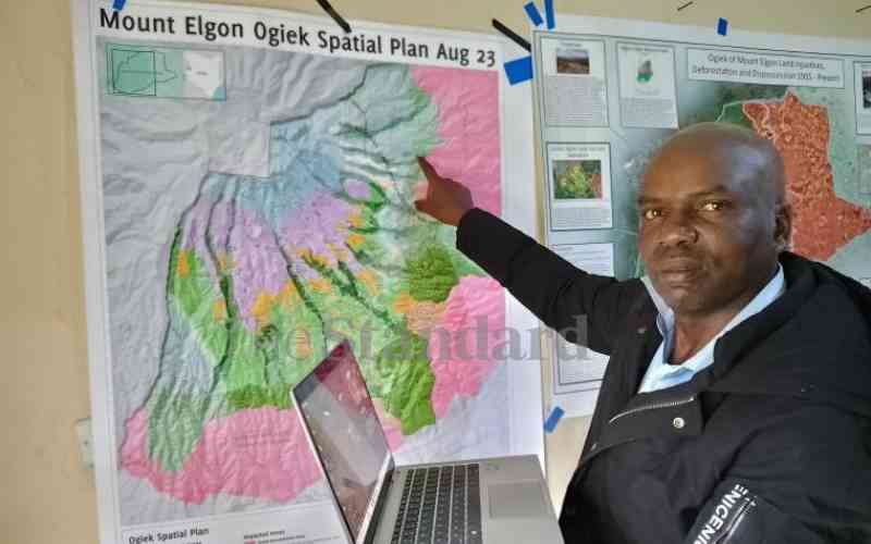
Eliud Kiboi shows a map of the land owned by the Ogiek community at Laboot headquarters in Mt Elgon, Bungoma County. [Mumo Munuve, Standard]

One of Kenya’s indigenous communities, the Ogiek, who settled in the country about 1,000 years ago, has tapped into technology to help preserve their culture and heritage on the verge of extinction.

The natives of the slopes of Mount Elgon that traverse the counties of Bungoma and Trans Nzoia are using a mobile application, Mapeo, that among other things, documents their traditional homeland with the key aim of preserving it against the rising exploration that is sweeping heritage sites dry.

Fight for restoration

“All we wanted in adopting the application was to map our Chepkitale ancestral land to describe the spatial aspects of our taboos and customs in relation to habitation, grazing and forest regeneration,” says Cherotwei Simotwo (Col Rtd), who is among the notable members of the Chepkitale Indigenous People Development Project behind the initiative.

“We really yearn to monitor a range of environmental impacts and encroachments by external actors in Chepkitale and the violations of our land ownership rights through the map. In so doing, we are also protecting the Mt Elgon water tower that supplies a huge chunk of western with water.”

A cursory look at the mapped Chepkitale area on the application depicts historical and ongoing encroachment and habitat conversion impacts on Ogiek’s customary land, with only a fraction of unadulterated areas remaining intact for the community’s access and activities.

The community says they won’t relent in fighting for restoration of the degraded areas within the catchment, which ironically happened when it was gazetted as a game reserve and put under the Kenya Wildlife Service (KWS) and Kenya Forest Service (KFS).

Last year September, they won back the land that holds their tribal headquarters, Laboot, which was deforested and are now letting the trees regenerate under strict monitoring using the application after convincing the court to reverse a 2008 gazettement of the core of their ancestral land to a game reserve (Chepkitale National Reserve).

Indigenous knowledge

Pius Muyai, a key witness who was actively involved in the case says the pain of successive evictions from the core of their ancestral land has played a key part in helping them defend their land just in case someone attempts to encroach on it.

The former civic leader played a key role in the case when he exposed the lack of public participation in the process that snowballed into the gazettement of the Ogiek land into a national reserve.

Eliud Kiboi, the chair of the mapping unit and Cosmus Murunga, the chairman of the community, says that they map “everything that belongs to us just to ward off potential ‘encroachers’ who may disturb and disinherit our future generations.”

The woodlands community of about 18,000 Ogieks in the country, with some 3,000 living around Mount Elgon, have mapped caves, bee hives, gravesites, water points and where they forage for forest produce.

They have also mapped areas where wildlife is frequent in their localities as they identify with most of the animals as the 32 sub-clans of the Ogiek have a totem in say a lion, elephant, buffalo and other common wildlife in the habitat.

This has helped their generation keep the forest lands they stay in intact using indigenous knowledge that discourages vices such as logging, which could lead to degradation of the forest and poaching.

Ogieks hold trees in high esteem as they act as meeting points and habitats for bees, which feed them with wild honey and refrain from poaching as killing wildlife will mean demeaning one of the 32 tribes that identify with the community.

Asked why the area under their occupation looks more lush and well-watered than the adjacent ones under the KWS and KFS, Murunga attributed it to their indigenous cultural practices.

“We gather honey, mushrooms, vegetables and medicinal plants, and graze our cattle and some sheep and goats on the high Chepkitale moorland of Mount Elgon and into the forests below the moorland in the dry season,” he says.

“We don’t do cultivation in Chepkitale apart from some small garden plots because crops do not grow well in Chepkitale, this way we pose almost zero damage to the environment.”