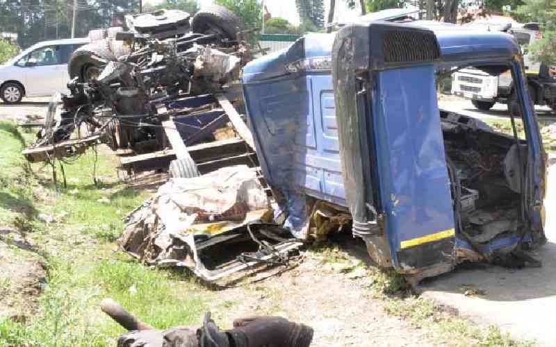
The grisly road accident at Londiani leading to deaths of over 50 people mostly pedestrians selling and buying wares within the road reserves of a national highway drew the attention of the entire nation to matters road safety. Messages of sympathy, condolences, anger and disappointment punctuated most of the conversations both on mainstream media and social media. Many solutions were proposed mostly condemning the road designs, vehicle roadworthiness, driver competency and state of mind, and road user behaviour. Unfortunately, the risk continues growing each passing day, calling for putting together of minds to find lasting solutions.
Road safety is not just about erection of road signs, traffic lights, installation of guardrails, road markings and zebra crossings here and there. To achieve meaningful and sustainable road safety, we must think about the bigger context of human spaces from the perspective of spatial planning and development control which is a long-forgotten path in Kenya’s national growth and development trajectory.
Spatial planning is the interdisciplinary practice of piecing together humans, their activities and their spaces in a manner that promotes functionality and sustainability. It ensures that children have access to playfields, schools and hospitals; people have liveable homes with access to markets, workplaces, recreational places; secures farmlands and links them with industries for processing and finally to markets completing the value chain; it secures minerals from their fields to factories and ultimately to markets while incorporating safety and sustainability.
All the spaces and functions are connected up using different types of road networks from highways, primary roads, secondary roads, minor roads, arteries, collectors, streets, lanes, avenues, crescents, closes, alleys, walks with different geometry and design typology depending on the purpose of the respective roads. A road is not just a road. It is defined by both its functions and geometry which determines how it is designed and accessorised.
The Constitution classifies roads into two broad classes. National trunk roads and county roads. The national trunk roads network is about 206,000 km of which 21,000 km are national highways (about 10 per cent). There’s a bigger network managed under county roads. In total, the national highways may constitute less than 5 per cent of all roads in kilometres.
In hierarchy and functionality, highways predominantly serve vehicles and less to no pedestrian traffic. Going lower, the primary roads (in rural) and arteries (in urban areas) carry a mix of vehicles and pedestrian traffic to a ratio of say 60: 40 kilometres respectively but with more weight to vehicles.
Secondary roads, minor roads and streets flip the ratios becoming heavy on pedestrian traffic and light on vehicular traffic. Walks carry 100 km pedestrian traffic with no motorised traffic allowed.
Design speeds follow the logic of functionality and hierarchy. Highways are designed to connect centres far from each other. They serve the three-prong purpose of mobility, ride quality/comfort and safety. They connect International or national centres separated by hundreds of kilometres. They are designed on the basics of links and nodes. Where the roads form links and cities/towns form the nodes. In essence spatial planning should ensure that nodes remain nodes and links to be links for proper functional, safe and sustainable designs. Design speeds for highways go as high as 100 kph plus. Certainly, such speeds are extremely risky to pedestrian traffic hence the reason there must be limited to no pedestrian direct access to highways.
Secondary roads, minor roads, estate roads, city arteries and streets are found within or close to nodes. They have lower design speeds with vehicles travelling at speeds as low as 20 kph or less. This allows pedestrians to weave with vehicles easily and safely while going about their businesses. Level crossings, non-motorised transport lanes, signs and signals are incorporated in the design of all these road typologies to make it work seamlessly and safely.
Functional spatial planning is usually expressed through georeferenced integrated development plans. The plans begin with zoning of available spaces depending on intended purpose; whether residential, industrial, agricultural, recreational, conservation and so on. It is through zoning that someone will know where residences should be, and how they interrelate with learning institutions, recreational facilities, markets, religious installations and other supporting services.
All government services to support these zones are accordingly designed; from power rating, water supply, sewer, piped gas, appropriate road cross sections and pavement structures and communication lines. Zoning also demarcates agricultural parcels, industrial areas, mines, conservation areas and riparian spaces. All these must be kept intact and protected through development control.
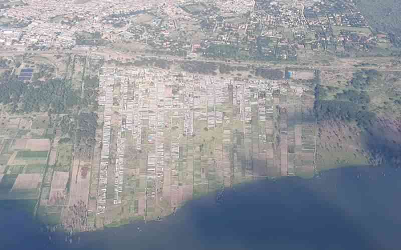
In the absence of practical spatial plans and development control, installations of heavy pedestrian activities move from nodes scattering along links on highways through sprawl. That’s how schools, markets and settlements end up on mobility roads and speedways. Our society’s traditional reaction is to call for installation of speed calming measures, which looks brilliant and empathetic at face value, but doesn’t solve the problem. Highways end up littered with bumps and signages attracting even more pedestrian activities on the carriageway. As a result, we are caught up in an ugly and endless retrofit interventions that have become our way of life until another disaster happens.
Key players need to put heads together to progressively fix spatial planning and development control to enable practical and sustainable road safety intervention among many other associated benefits. This can be actualised through action by Ministry of lands, Ministry of Roads and county governments in collaboration with other stakeholders with undivided support from The Presidency. Hard decisions have to be made now to restore order and save the future of the nation. If the journey from disorder to order worked for Singapore, for Tokyo and other developed cities, it can work for Kenyan cities too.
Subscribe to our newsletter and stay updated on the latest developments and special offers!