Kenya is set to conduct a detailed survey to determine the quantity of its underground minerals. In readiness for this, the Mining ministry has embraced Geographical Information System (GIS), a technology used to map mines and the other natural resources.
The ministry recently invited consultants to help it develop a proposal for the planned geophysical survey.
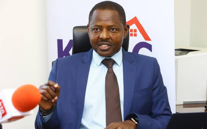
Speaking Wednesday at a conference for mining companies that have also chosen to embrace GIS, Robert Mugo, technical advisor to Mining Cabinet Secretary Dan Kazungu said so far, the ministry has been able to identify mines and other natural resources using this technology.
The conference was organised by Esri Eastern Africa, a company that offers GIS technology solutions in the country. “The use of relevant scientific technologies and engineering techniques for the exploitation and utilisation of the country’s natural resources is inevitable,” said Dr Mugo while reading Mr Kazungu’s speech.
He also explained the use of survey, mapping and remote sensing, all of which are part of GIS, cannot be ignored if the country were to fully exploit its natural resources.
Current Population
As part of its Vision 2030 blueprint, the Government has moved to ensure that all its ministries, and now county governments, embrace GIS to enable them manage resources within their dockets.
County governments are now required by law to form Geo-spatial units within their locality, which use GIS, to enable them come up with data to enable them manage county resources better. Counties are now expected to use such data to accurately plan and build new infrastructure and improve revenue collection without wastage.
Victor Mutua, an official with Esri Eastern Africa, said GIS would provide data on how many assets counties have, where they are, when they are maintained and whether they are paid for. It would also be easy to know the current population and the annual population growth rate in counties. Mr Mutua explained that the advantages of GIS in the planning process are huge.
“First, it will reduce project costs by eliminating redundancy, and data acquisition will be free. Secondly, it will speed up the decision-making process since all data will be available at the click of a button. Therefore efficiency would be improved both within government and the private sector,” Mutua said.
Exploration firms have been forced to carry out their own expensive mini-surveys as there is no public database of what minerals Kenya has. Kenya has attracted huge interest from both local and foreign firms seeking to exploit the country’s vast mineral potential.
When the survey is complete, data will be made available to investors at a fee.
 The Standard Group Plc is a multi-media organization with investments in media
platforms spanning newspaper print operations, television, radio broadcasting,
digital and online services. The Standard Group is recognized as a leading
multi-media house in Kenya with a key influence in matters of national and
international interest.
The Standard Group Plc is a multi-media organization with investments in media
platforms spanning newspaper print operations, television, radio broadcasting,
digital and online services. The Standard Group is recognized as a leading
multi-media house in Kenya with a key influence in matters of national and
international interest.